Fichier:Pacific Area - The Imperial Powers 1939 - Map.jpg
Original-Fichier (1.202 × 917 Pixel, Fichiersgréisst: 615 KB, MIME-Typ: image/jpeg)
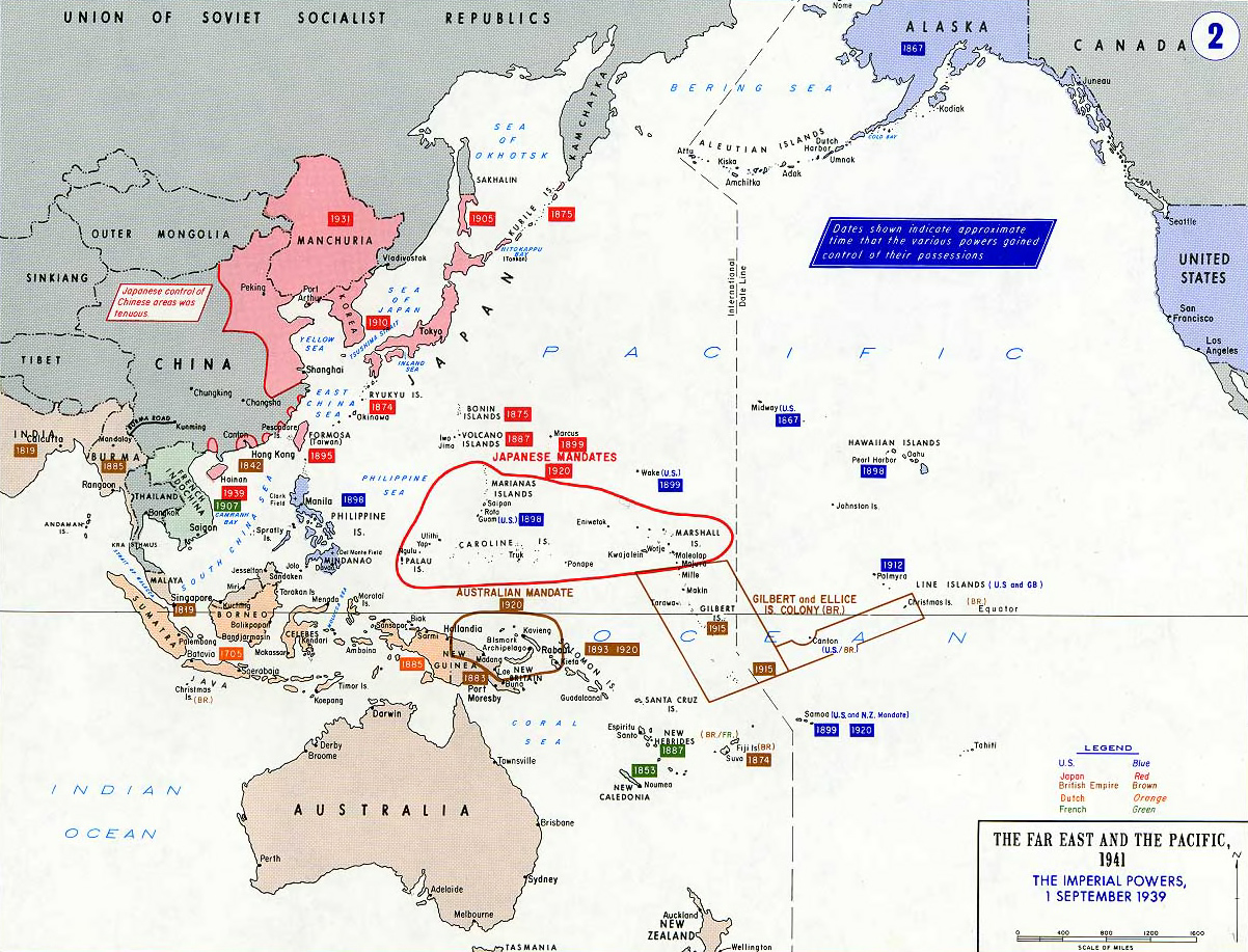
- Description: Pacific War - The Imperial Powers 1939
- Source: https://www.westpoint.edu/
- Background information:
In 1938 the predecessors of what is today The Department of History at the United States Military Academy began developing a series of campaign atlases to aid in teaching cadets a course entitled, "History of the Military Art." Since then, the Department has produced over six atlases and more than one thousand maps, encompassing not only America’s wars but global conflicts as well.
In keeping abreast with today's technology, the Department of History is providing these maps on the internet as part of the department's outreach program. The maps were created by the United States Military Academy’s Department of History and are the digital versions from the atlases printed by the United States Defense Printing Agency. We gratefully acknowledge the accomplishments of the department's former cartographer, Mr. Edward J. Krasnoborski, along with the works of our present cartographer, Mr. Frank Martini.
Please be aware that these maps are large in file size and may require substantial download times.
Dieses Bild wurde von einem Mitglied der United States Army während der Ausführung seiner Dienstpflichten erstellt. Als eine Arbeit der Bundesregierung der Vereinigten Staaten ist dieses Bild in public domain.
|
 |
derivative works
Derivative works of this file: Hokushin-ron-Map.svg

|
File:Pacific Area - The Imperial Powers 1939 - Map.svg ist eine vektorisierte Version dieses Bildes. Diese sollte an Stelle des Rasterbildes verwendet werden, sofern sie nicht schlechter ist.
File:Pacific Area - The Imperial Powers 1939 - Map.jpg → File:Pacific Area - The Imperial Powers 1939 - Map.svg
Für weitere Informationen siehe Help:SVG. |
 |
Versiounen
Klickt op e bestëmmten Zäitpunkt fir déi respektiv Versioun vum Fichier ze kucken.
| Versioun vum | Miniaturbild | Dimensiounen | Benotzer | Bemierkung | |
|---|---|---|---|---|---|
| aktuell | 21:01, 19. Jun. 2010 | | 1.202 × 917 (615 KB) | Ras67 | cropped |
| 10:32, 15. Okt. 2005 |  | 1.261 × 971 (203 KB) | W.wolny |
Benotze vu Fichieren
Dës Säit benotzt dëse Fichier:
Globaalt Benotze vum Fichier
Dës aner Wikie benotzen dëse Fichier:
- Benotzt op be-tarask.wikipedia.org
- Benotzt op da.wikipedia.org
- Benotzt op de.wikipedia.org
- Benotzt op en.wikipedia.org
- Benotzt op ja.wikipedia.org
- Benotzt op lt.wikipedia.org
- Benotzt op pl.wikipedia.org
- Benotzt op pt.wikipedia.org
- Benotzt op zh.wikipedia.org