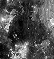
Fichier:Mare Cognitum.jpg
Mare_Cognitum.jpg (350 × 382 Pixel, Fichiersgréisst: 17 KB, MIME-Typ: image/jpeg)
Versiounen
Klickt op e bestëmmten Zäitpunkt fir déi respektiv Versioun vum Fichier ze kucken.
| Versioun vum | Miniaturbild | Dimensiounen | Benotzer | Bemierkung | |
|---|---|---|---|---|---|
| aktuell | 00:40, 1. Jun. 2007 |  | 350 × 382 (17 KB) | Bryan Derksen | {{Information |Description={{en|en:Mare Cognitum is located in a basin or large crater which sits in the sencond ring of the Procellarum basin. The mare formations are of the Upper Imbrian epoch, while the surrounding basin material is of the Lower I |
Benotze vu Fichieren
Dës Säit benotzt dëse Fichier:
Globaalt Benotze vum Fichier
Dës aner Wikie benotzen dëse Fichier:
- Benotzt op be.wikipedia.org
- Benotzt op ca.wikipedia.org
- Benotzt op cs.wikipedia.org
- Benotzt op de.wikipedia.org
- Benotzt op en.wikipedia.org
- Benotzt op es.wikipedia.org
- Benotzt op fa.wikipedia.org
- Benotzt op fr.wikipedia.org
- Benotzt op he.wikipedia.org
- Benotzt op id.wikipedia.org
- Benotzt op it.wikipedia.org
- Benotzt op ka.wikipedia.org
- Benotzt op ko.wikipedia.org
- Benotzt op la.wikipedia.org
- Benotzt op nl.wikipedia.org
- Benotzt op pl.wikipedia.org
- Benotzt op pt.wikipedia.org
- Benotzt op ru.wikipedia.org
- Benotzt op sr.wikipedia.org
- Benotzt op sv.wikipedia.org
- Benotzt op uk.wikipedia.org
- Benotzt op www.wikidata.org
- Benotzt op zh-min-nan.wikipedia.org
- Benotzt op zh.wikipedia.org


