Fichier:Debris-GEO1280 p.jpg
Original Fichier (1.280 × 1.280 Pixel, Fichiersgréisst: 146 KB, MIME-Typ: image/jpeg)
Resumé
| Beschreiwung |
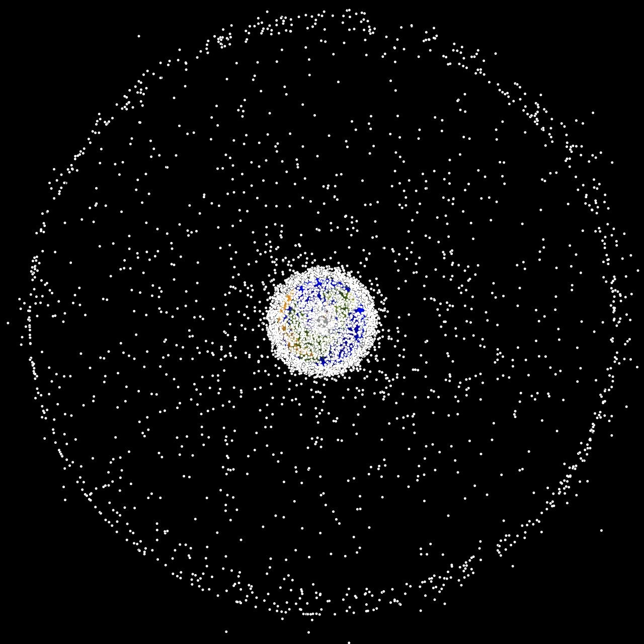
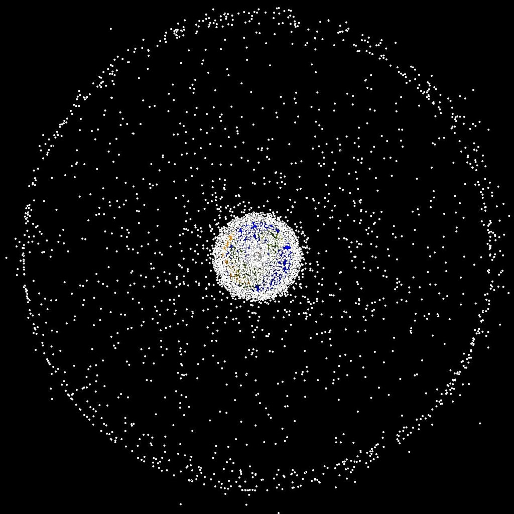
English: Debris plot by NASA The following graphics are computer generated images of objects in Earth orbit that are currently being tracked. Approximately 95% of the objects in this illustration are orbital debris, i.e., not functional satellites. The dots represent the current location of each item. The orbital debris dots are scaled according to the image size of the graphic to optimize their visibility and are not scaled to Earth. These images provide a good visualization of where the greatest orbital debris populations exist. Below are the graphics generated from different observation points. |
| Quell | http://orbitaldebris.jsc.nasa.gov/photogallery/beehives.html |
| Auteur | NASA |
Lizenz
| Diese Datei ist gemeinfrei (public domain), da sie von der NASA erstellt worden ist. Die NASA-Urheberrechtsrichtlinie besagt, dass „NASA-Material nicht durch Urheberrecht geschützt ist, wenn es nicht anders angegeben ist“. (NASA-Urheberrechtsrichtlinie-Seite oder JPL Image Use Policy). | ||
 |
Warnung:
|
Versiounen
Klickt op e bestëmmten Zäitpunkt fir déi respektiv Versioun vum Fichier ze kucken.
| Versioun vum | Miniaturbild | Dimensiounen | Benotzer | Bemierkung | |
|---|---|---|---|---|---|
| aktuell | 16:47, 1. Feb. 2005 | | 1.280 × 1.280 (146 KB) | Srbauer | debris plot by NASA |
Benotze vu Fichieren
Dës Säit benotzt dëse Fichier:
Globaalt Benotze vum Fichier
Dës aner Wikie benotzen dëse Fichier:
- Benotzt op af.wikipedia.org
- Benotzt op af.wiktionary.org
- Benotzt op ar.wikipedia.org
- Benotzt op de.wikipedia.org
- Benotzt op hu.wikipedia.org
- Benotzt op it.wikipedia.org
- Benotzt op pt.wikipedia.org
- Benotzt op ru.wikipedia.org
- Benotzt op simple.wikipedia.org
- Benotzt op sv.wikipedia.org
- Benotzt op sw.wikipedia.org