Fichier:Arrondissement de Toul.PNG

Gréisst vun dëser Duerstellung: 750 × 600 Pixel. Aner Opléisungen: 300 × 240 Pixel | 600 × 480 Pixel | 850 × 680 Pixel.
Original-Fichier (850 × 680 Pixel, Fichiersgréisst: 11 KB, MIME-Typ: image/png)
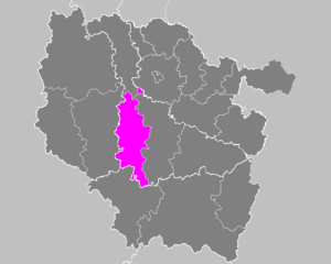
| Beschreiwung | Maps of arrondissements and cantons of France: Arrondissement de Toul.PNG | ||
| Datum | |||
| Quell | Eegent Wierk | ||
| Auteur | M.Minderhoud | ||
| Autorisatioun (Dëse Fichier nach eng Kéier benotzen) |
|
Versiounen
Klickt op e bestëmmten Zäitpunkt fir déi respektiv Versioun vum Fichier ze kucken.
| Versioun vum | Miniaturbild | Dimensiounen | Benotzer | Bemierkung | |
|---|---|---|---|---|---|
| aktuell | 23:30, 15. Feb. 2010 | | 850 × 680 (11 KB) | Entlinkt | Exclave fixed, cf. http://www.insee.fr/fr/methodes/nomenclatures/cog/carte_comcan.asp?codecan=5426 |
| 17:41, 21. Nov. 2006 |  | 850 × 680 (31 KB) | Michiel1972 | {{Information |Description= Maps of arrondissements and cantons of France: {{subst:PAGENAME}} |Source= |Date=november 2006 |Author= M.Minderhoud |Permission= {{PD-self}} |other_versions= }} [[Category:Maps of arrondisseme |
Benotze vu Fichieren
Dës Säit benotzt dëse Fichier:
Globaalt Benotze vum Fichier
Dës aner Wikie benotzen dëse Fichier:
- Benotzt op az.wikipedia.org
- Benotzt op fa.wikipedia.org
- Benotzt op it.wikipedia.org
- Benotzt op pl.wikipedia.org
- Benotzt op ro.wikipedia.org
- Benotzt op ru.wikipedia.org
- Benotzt op sk.wikipedia.org
- Benotzt op sl.wikipedia.org